Silvisense automated forest monitoring
Quick information
- Available
At a glance
- Web-based forest monitoring
- Automatically downloads new satellite data as it becomes available
- Makes it easier to identify forest disturbances at an early stage
The Silvisense service provides automated forest monitoring using satellite data and state-of-the-art algorithms.
The forestry sector must capture disturbance outbreaks in a timely manner to limit damage to forests and corresponding loss of value.
In Europe, insects, disease and wildlife are the most frequently reported damaging agents. The forested area affected by these nearly doubled between 1990 and 2005. As of 2005, forest disturbances affected over 5.83 per cent of the total forested area in Europe. With a production turnover of roughly EUR 387 billion, forest disturbances cost Europe some EUR 22 billion annually.
Accurate forest monitoring
Manual identification of disturbance outbreaks in trees is time-consuming and often inaccurate. Remotely sensed, multispectral imaging, on the other hand, yields consistent, highly accurate results. It is simple to use and non-destructive, allows for rapid assessments and has a broad range of applications.
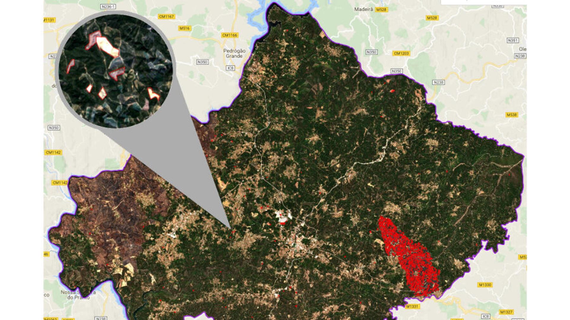
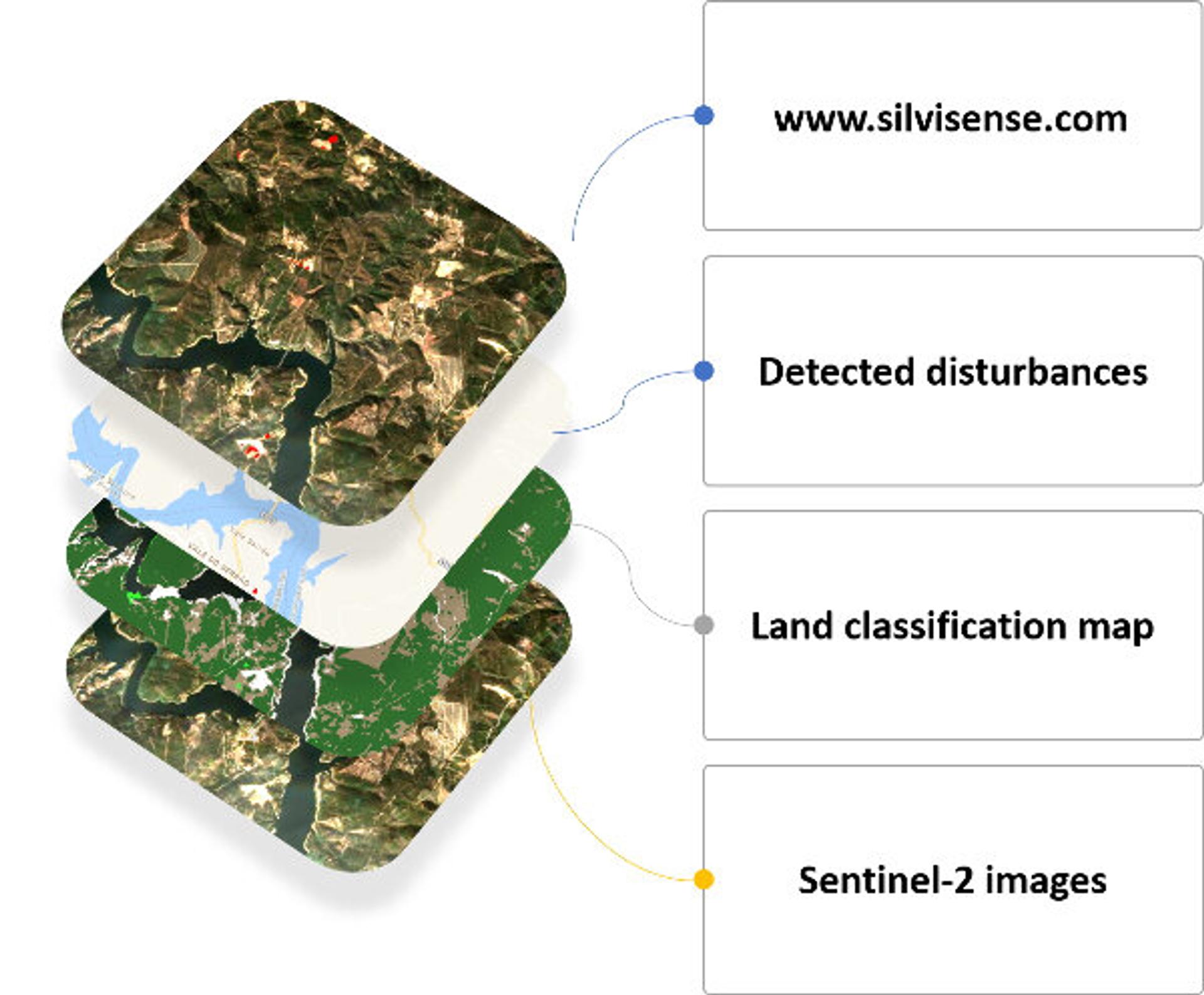
The Silvisense service combines Sentinel-2 imagery with state-of-the-art algorithms to perform scalable and fully automated data analyses.
Silvisense automatically downloads new satellite data in a specified area of interest as it becomes available. The data is then processed to find any changes in the forest. The information provided to users needs no further interpretation. The results can be inspected and downloaded from the Silvisense website or via WMS server.
A range of products is available for subscription via the Silvisense API, including:
- Pine disturbance maps
- Clear-cut validation maps
- Land classification maps
- Updated, tailored satellite imagery over selected regions
- Forest fire mapping
- Drought mapping
Concrete benefits
The Silvisense service enables users to detect disturbance outbreaks at an earlier stage and clear-cut the declining trees accordingly. The developers of Silvisense estimate that this may result in a 60 per cent reduction in corresponding disease outbreak during the following season and a 4 per cent increase in total forest value.
Producers of timber and wood products in particular can benefit from mitigating the effects of forest disturbances.
Market potential
The Silvisense service has been rolled out in two European countries thus far. To further develop the service, feedback is being gathered from pilot customers ranging in size from private small-scale forest owners and end-to-end timber and wood products companies to forest owners associations and government entities.
Advancing the Sustainable Development Goals

Contact info